Tail of the Dragon: By the Numbers
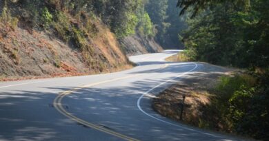
There’s a road in a remote stretch of the Great Smoky Mountains backcountry, where Tennessee meets North Carolina, that everyone raves about – US Highway 129, famously known as the Tail of the Dragon. This road is loved by motorcyclists and sports car enthusiasts alike for its intense series of cambered and off-cambered corners enticing responsible riders to momentarily let loose.
This magical region, west of the Smokies, tucked amid rugged rolling terrain in the Cherokee and Nantahala National Forests, is a playground where riders will find challenging roads in all directions and scenery rich in American history at virtually every turn. But among so many choices, no single stretch concentrates the mind and thrills the soul like the Tail of The Dragon.
Here’s a look at the Tail of the Dragon by the numbers.
More Than a Country Road
US 129 was created as part of the national U.S. Highway System in 1926, linking Knoxville, Tennessee, with towns in western North Carolina. The section known as the Tail of the Dragon was designed to traverse the Great Smoky Mountains, offering a connection through the rugged terrain between Maryville, TN and Robbinsville, NC.
By the Numbers:
- Constructed: 1926
- Intersecting roads: 0
- Driveway access: 0
- Forest service road access: some
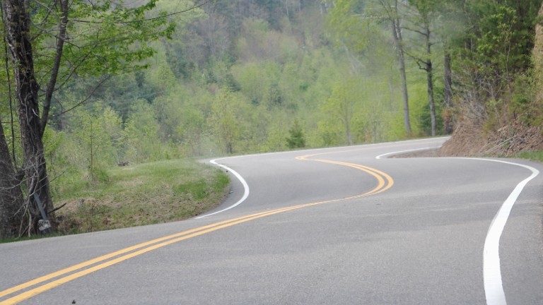
Because of the steep, mountainous terrain, engineers followed the Cherokee Indian trails along natural ridgelines and valleys, resulting in the now-famous 318 curves packed into just 11 miles. This twisting layout wasn’t designed for thrill-seeking – it was simply the most practical way to cut through the mountains without tunnels or massive grading, both of which were too expensive at the time.
Start and End Points
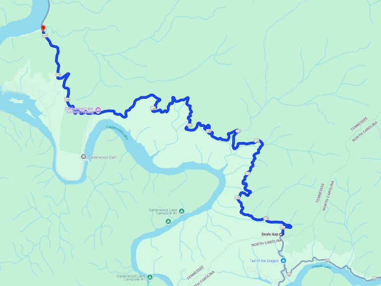
The Tail of the Dragon runs in a generally north-south direction from the North Carolina state line into Tennessee, stretching between Deals Gap and the Tabcat Creek boat ramp on Chilhowee Lake, just south of the historic area of Chilhowee, Tennessee.
By the Numbers:
- Road length: 11 miles
- Straight-line distance: 5.25 miles
- Ride time: 20 to 30 minutes on average
At the northern end of the Dragon, US 129 approaches Chilhowee Lake – a quiet, scenic spot steeped in Cherokee history and framed by the Smoky Mountains. From here, the curves fade as the road meanders onward to Maryville.
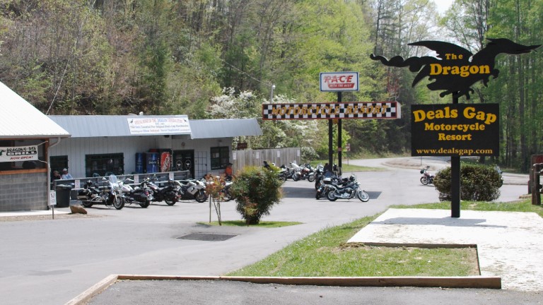
On the southern end, US 129 descends into Deals Gap, a remote mountain pass nestled in the western reaches of North Carolina. Surrounded by dense hardwood forests and crossed by streams that trace the slopes of the Great Smoky Mountains, the area is defined by its rugged terrain and natural isolation. From here, continuing south, the road passes the junction with NC state route 28 as it approaches Cheoah Lake and the Cheoah Dam.
Miles of Curves
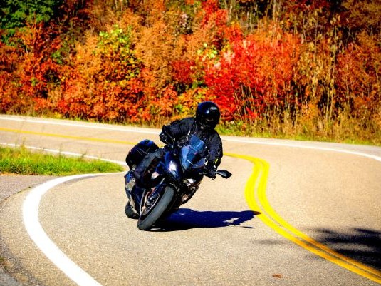
Stretching just 11 miles through the Appalachian backcountry, this narrow strand of pavement is known less for distance than for density. Riders navigate 318 curves – roughly 29 per mile, or about 1.6 every 100 yards – without a single intersecting road or driveway to interrupt the flow. It is a simple two lane road with a distinct feeling of isolation, marked by double-yellow lines end-to-end but with occasional pull-offs.
By the Numbers:
- Number of curves: 318
- Passing areas: 0
As the crow flies, the end points of this route are only 5.25 miles apart, a reminder of how tightly wound the pavement becomes as it clings to the mountainside. Northbound riders experience a net elevation loss of 874 feet, a relatively modest change that subtly reshapes the feel of the ride making it worthwhile to try this road in both directions.
Depending on pace and picture stops, riders may complete the journey in as little as 20 minutes. But don’t make it a sprint. The real satisfaction comes from finding a smooth rhythm and picking proper lines, while managing speed and braking.
Patrolled for Everyone’s Safety
Law enforcement presence on the Tail of the Dragon is constant, particularly on weekends when traffic surges. Both Tennessee and North Carolina highway patrol officers monitor the road, employing radar, marked cruisers, and unmarked vehicles to curb reckless riding and speeding.
By the Numbers:
- Posted speed: 30mph
- Average speed: 30 to 45 mph
- Tickets issued annually: over 850
- Accidents: more than 90 each year, over half involving motorcycles
- Fatalities: an average of 1.5 per year
The posted speed limit holds steady at 30 miles per hour from end to end. In practice, most riders travel between 30 and 45 mph, though more aggressive, less cautious ones significantly exceed that tempo. It’s easy to forget that Highway 129, and the section known as the Tail of the Dragon, remains a public mountain road, shared with two-way traffic, composed of many blind corners, and with virtually no run-off. The consequences for a bad line or missed braking point can be severe.
Exact enforcement statistics are scarce, but a snapshot from an 18-month period between 2015 and 2017 shows just how active patrols can be. During that time, officers issued 2,300 citations, including 861 in 2016 alone – an average of roughly four tickets every day.
The accident rate follows the road’s reputation. Between 2020 and 2021, there were 182 recorded accidents, more than half involving motorcycles. On average, the Dragon sees about 1.5 fatalities per year, though that number can spike; for example, in 2021 there were eight reported deaths.
A Busy Rural Highway
Despite its remote setting, the Dragon sees steady traffic throughout the warmer months. The road’s narrow corners and numerous blind curves have led to a restriction on semi-truck traffic. Nevertheless, semi drivers sometimes mistakenly find their way onto the Dragon reinforcing the need for riders to exercise vigilance, especially around blind corners.
By the Numbers:
- Annual motorcycle riders: 240,000
- Weekend riders (April thru October): 800-1200
- Weekday riders (April thru October): 100 to 200
- Busiest time: 10am to 4pm
- Rainy days: 90 to 110 April through October
An estimated 240,000 motorcyclists ride the Dragon each year, most of them between April and October. On a typical spring-through-fall weekend, the road hosts anywhere from 800 to 1,200 riders, with numbers surging past 1,500 on holiday weekends. The busiest hours, not surprisingly, are between 10 a.m. and 4 p.m.. Early morning rides are preferred to avoid peak traffic and possible late afternoon thunderstorms.
Weekdays tell a different story. With fewer tourists and group rides, traffic drops significantly – sometimes to as few as 100 to 200 riders, depending on the weather.
Rain is a regular feature in this part of the country between April and October. The region experiences 90 to 110 rainy days, amounting to nearly half of all the days in the entire riding season. Early spring brings the most frequent rainfall. Summer days often see a passing afternoon thunderstorm, while fall tends to be the driest time of the year.
A Tale to Tell
The tail of the Dragon wasn’t made for motorcycling, but through what seems like divine inspiration it turned out that way. Motorcyclists from all over the country and all over the world continue to make a pilgrimage to this remote area tucked in the foothills of the Great Smoky Mountains to experience this American treasure.
Come prepared to share the road with riders at all levels of experience, yield to the faster riders and be patient with the slow ones. Bring your camera, your GoPro, or just a clear mind to remember the day. It is bound to be unforgettable.
For more about riding the Dragon, read Riding Tips for Twisty Roads.
Did you like this article?
Thank you for your feedback!
Please email the editor with any additional comments.
Your feedback is used only by American Sport Touring. We do not store or sell your information.
Please read our Privacy Policy.

by John DeVitis, Editor and Publisher
John DeVitis, Editor & Publisher of American Sport Touring, has spent years riding and writing with a focus on long-distance, performance-oriented motorcycling. His time on the road has revealed little-known routes across the United States and Canada, along with practical insights into the bikes, gear, and techniques that matter to sport touring riders. He draws on this experience, together with a background in digital publishing, to guide the editorial principles and clear vision behind American Sport Touring, delivering content riders can trust.