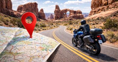
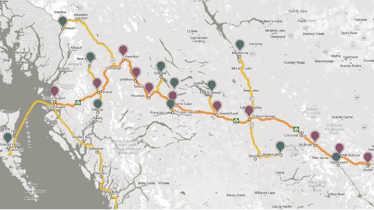
Motorcycling on Little Known Route 16 in British Columbia
For sport touring riders, the thrill of the open road lies in the perfect combination of sweeping curves, breathtaking scenery, and a route that beckons for exploration. British Columbia’s Route 16, stretching across the province from the towering peaks near Mount Robson to the rugged Pacific coastline of Prince Rupert, delivers exactly that. This highway—often called the Yellowhead Highway—winds through mountain passes, alongside pristine lakes, and into remote wilderness, making it an ideal destination for riders seeking adventure.
The Backstory on Route 16
Route 16, also known as the Yellowhead Highway, has a rich history rooted in early exploration and trade. The route follows old Indigenous pathways and trails that were later used by fur traders in the early 19th century. It gets its name from Pierre Bostonais, a Métis-Iroquois guide and trapper known as “Tête Jaune” (French for “Yellow Head”) because of his distinctive light-colored hair. Bostonais played a key role in leading fur traders through the Rocky Mountains, paving the way for commerce and settlement in the region. By the mid-20th century, the push for a trans-provincial highway led to the development of Route 16 as part of Canada’s Yellowhead Highway system, connecting British Columbia’s interior with the Pacific coast.
From Peaks to the Pacific
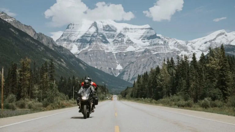
Starting at Mount Robson, the highest peak in the Canadian Rockies, Route 16 quickly sets the tone for what’s ahead: grand vistas, long open stretches, and sections of engaging, twisty pavement. Riders heading west pass through Tête Jaune, an important crossroads for travelers, before reaching McBride, a quiet town nestled in the Robson Valley with stunning views of the Cariboo Mountains.
Further along, the road reveals the hidden gems of Ancient Forest Provincial Park, home to towering cedars and one of the world’s rare inland temperate rainforests. Walking among these massive old-growth trees is a unique and humbling experience, making it a worthy stop.
The Heart of the Ride: Lakes, Rivers, and Mountain Passes
West of Prince George, the character of the ride shifts as the highway carves through British Columbia’s interior plateau, passing by Vanderhoof, Fraser Lake, and Burns Lake. These sections provide sweeping open roads perfect for soaking in the scenery at a brisk pace. Houston, with its famous steelhead fishing, offers a good stop before hitting the more technical portions of the route near Smithers and Moricetown.
Smithers, in particular, is a highlight for riders. The town has a distinct alpine character, complete with a Swiss-style main street, and sits beneath the stunning Hudson Bay Mountain. Smithers is also a hub for outdoor activities, making it an ideal stop to refuel and explore.
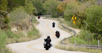
From here, Route 16 continues to The Hazeltons, a historically rich area home to Indigenous culture and spectacular canyon views. This section is where the road starts to bring in more curves, making it particularly engaging for sport touring bikes.
Coastal Adventures and Side Trips
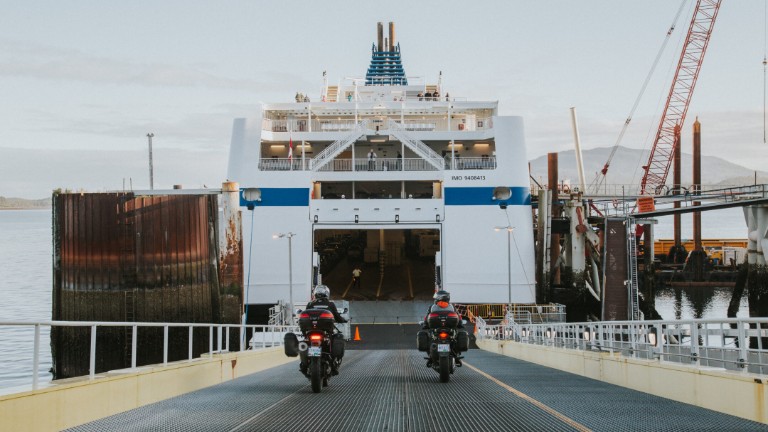
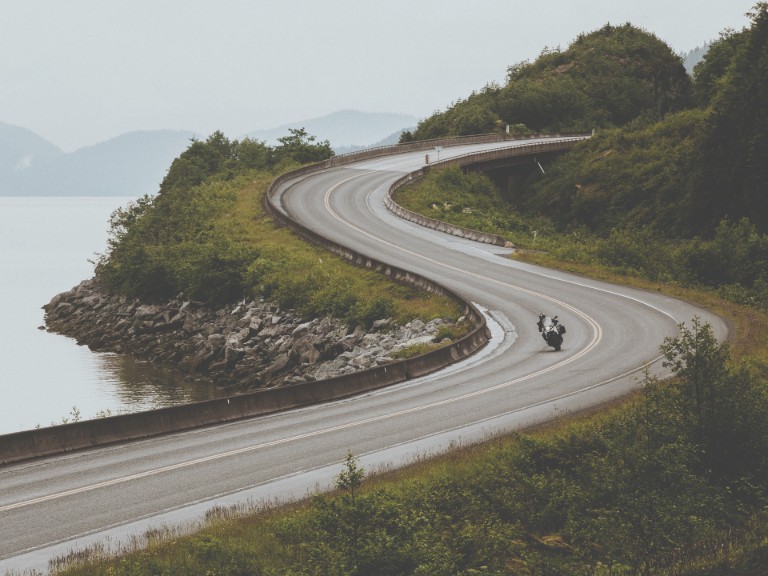
As Route 16 approaches the coast, the landscape becomes dramatic, with mountains crowding the highway and the Skeena River guiding the way. The ride into Terrace and then toward Prince Rupert is exhilarating, offering some of the most scenic river-valley riding in Canada. Prince Rupert itself is the gateway to the legendary Haida Gwaii, a bucket-list side trip for any touring rider willing to hop on a ferry to explore its remote beauty. Haida Gwaii is known for its rich Indigenous culture, rugged coastlines, and stunning natural beauty, making it a once-in-a-lifetime destination.
Beyond the main route, numerous side trips add to the adventure. Heading south from Terrace, riders can take the road to Kitimat, a small coastal town at the end of a twisty highway. Another must-ride detour is the Nisga’a Highway, which cuts through volcanic landscapes in the Nass Valley—an unforgettable ride featuring tight corners, open straights, and remote wilderness. The volcanic scenery along this route is striking, with ancient lava beds and steaming hot springs providing a surreal riding backdrop.
Northern Exploration and Historic Stops
For riders looking to venture even further, the northern and eastern extensions of Route 16 provide endless opportunities. Fort St. James, with its well-preserved National Historic Site, showcases the region’s fur-trading history. Meanwhile, Barkerville, a gold rush-era town, offers a step back in time along a fun, winding road leading into the Cariboo Mountains.
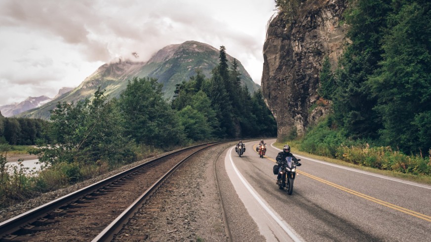
More remote but equally rewarding rides include routes to Mackenzie, Granisle, and Stewart, the latter of which offers jaw-dropping views of glaciers and fjords. Stewart’s proximity to the Alaskan border also makes it a unique and exciting stop. Riders who make it here will be treated to the sight of the towering Bear Glacier and have the opportunity to cross into Hyder, Alaska, for a truly remote riding experience.
Sport Touring Riders Will Love Route 16
The best time to ride Route 16 is from late spring to early fall, when temperatures are mild, and road conditions are at their best. Summer (June-August) offers the most favorable riding weather, with warm temperatures in the interior and cooler conditions near the coast. Early fall (September) brings stunning autumn colors, making for a spectacular ride, while late spring (May) allows riders to experience the awakening landscapes with fewer travelers on the road.
Route 16 provides a perfect mix of long, open roads for stretching the legs of a sport touring bike and curvy sections that demand precision and skill. With low traffic in many areas and a backdrop of mountains, rivers, and forests, it’s a route that never feels dull. The variety of landscapes—Rocky Mountain passes, coastal rainforests, high plains, and river valleys—ensures that no two sections feel the same.
For those who crave long-distance sport touring with a mix of fast sweepers and technical twists, British Columbia’s Route 16 is a ride to remember. Whether taking it end to end or exploring its many side roads and scenic detours, this is a journey that delivers excitement, challenge, and the unfiltered beauty of Canada’s wild landscapes.
For more information visit Route16.ca or download the route map.
Share Your Thoughts
Thank you for your feedback!
Please email the editor with any additional comments.
Your feedback is used only by American Sport Touring. We do not store or sell your information.
Please read our Privacy Policy.

by John DeVitis, Editor and Publisher
John DeVitis, Editor & Publisher of American Sport Touring, has spent years riding and writing with a focus on long-distance, performance-oriented motorcycling. His time on the road has revealed little-known routes across the United States and Canada, along with practical insights into the bikes, gear, and techniques that matter to sport touring riders. He draws on this experience, together with a background in digital publishing, to guide the editorial principles and clear vision behind American Sport Touring, delivering content riders can trust.