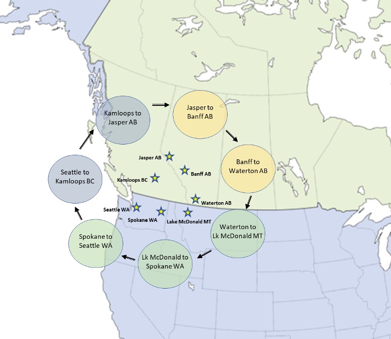
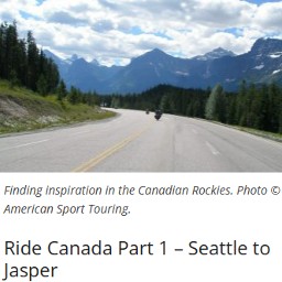
Ride Canada Part 1 – Seattle to Jasper
With so many good roads to ride in the US, why would anyone venture north of the border? This three part tour through the Canadian Rockies with stops in Jasper, Banff, and Waterton will emphatically answer that question and leave one looking forward to exploring more of Canada’s pristine back roads.
Tour Highlights
There’s more to discover on this tour than a few short articles can describe. But to give a sense of what lies ahead, here are a few highlights…
- Ride the western-most segment of Trans-Canada Highway 1 as it makes its way through the Fraser Valley, first along BC’s longest river, the Fraser River, and then bending and twisting with its largest tributary, the Thompson River.
- Enjoy meandering through miles of unspoiled forests in British Columbia and Alberta, Canada’s two western provinces.
- Get to know three of Canada’s earliest National Parks – Jasper National Park, Banff National Park, and Waterton Lakes National Park.
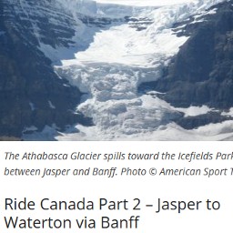
- Enjoy a ride on the Icefields Parkway, judged one of the top drives in the world by Conde Nast, with scenic stops through the largest icefields in the Rocky Mountains, a collection of 6 major glaciers covering 125 square miles between Jasper and Banff.
- And then back in the USA, ride the famous Going to the Sun Road in Montana through Glacier National Park to the serene shores of Lake McDonald.
A Tour in Three Parts
This three part tour starts and ends in Seattle. The first segment, described in this article, travels from Seattle Washington to Jasper Alberta. The two remaining legs make their way from Jasper to Waterton Alberta via Banff and then from Waterton through Glacier National Park to Lake McDonald before returning to Seattle.
Each segment of the tour is made up of three riding days and two nights. Each day as well as each tour segment continues where the previous day ended. Taken together, that’s a total of 6 riding days and 5 nights. Of course, riders can choose to start and end the tour at any point along the way, and some may want to spend extra days in the national parks.
So grab your passport and get ready to meet our neighbors to the north.
Riding in Canada is a Lot Like Riding in the US
For the most part riding in Canada is no different than riding in the States. But there are a few things riders should be aware of before setting out across the border.
Crossing the Border
Riders entering Canada must show either a valid passport or a state issued enhanced drivers license. One of the same is required to re-enter the US.
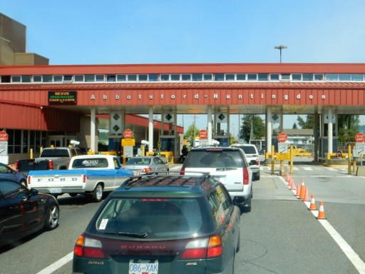
What actually happens at the border gate is entirely up to border agent and how one answers the agent’s questions. Questions typically include “where’s home”, “where are you heading”, “how long will you be in Canada”, and at least one about restricted or prohibited items (which include firearms, cannabis, and illegal drugs). The agent may also ask the rider to remove their helmet or send them to secondary inspection.
To avoid problems at the border, check the Canadian Government Website for information on restricted items. It’s a good idea to also read-up on US Restrictions.
Weather
Both British Columbia and Alberta have relatively temperate climates. Summer highs are higher and lows are lower as one moves from the coast of British Columbia to the interior Rocky Mountains and then onto the plains of Alberta. Expect daytime summer temperatures to average between 65°F and 85°F. Nighttime temperatures are much cooler, and sometimes will dip below 40° in Alberta.
Plentiful amounts of rain throughout the year keep Canadian forests green but won’t pose a problem for riders in eastern British Columbia and Alberta. Summer months are the driest and Alberta boasts the most sunny days of anywhere in Canada.
But like any ride that extends across a variety of landscapes, it’s wise to be ready for fast changing weather, particularly in the higher elevations.
Speed Limits
The most noticeable difference is the speed limits. Canada uses the metric system, consequently speeds are posted in kilometers per hour. Highway speeds in British Columbia are either 100 kph (62 mph) or 110 kph (68 mph) depending on the type of highway (e.g. rural, divided). Highway speeds in Alberta are lower at 80 kph (50 mph) and 100 kph (62 mph) again depending on the highway.
Gas Prices
Beyond speed limits, gas stations sell gas by the liter, so multiple the cost per liter by 3.8 to come up with a comparable price per gallon. Gas prices in Canada always seem to be a little higher than in the US, but considering that the Canadian dollar trades for roughly 26% less than a US dollar (as of this writing) the actual cost can be pretty reasonable. For example, in Alberta a gallon of gas cost an average of $4.93 Canadian, while in British Columbia a gallon cost $6.29 Canadian. That’s the equivalent of $3.65 and $4.66 USD per gallon respectively.
One more point about gassing up in Canada. Many Canadian stations won’t accept an American credit card at the pump. Instead, one has to pay inside. That adds time to fuel stops, particularly if a receipt is needed.
Cash and Credit Cards
Canadian merchants may or may not accept US dollars. If they do, the foreign exchange rate they offer is likely less than the official rate. Exchange rates fluctuate day to day, but for the past few years have been stuck in the $1.35CDN to $1USD range. Check the Bank of Canada website for current daily exchange rates (bankofcanada.ca).
In most cases It’s more convenient and cost effective to use credit cards whenever possible.
Cell Coverage
Mobile phone coverage across Canada is generally excellent. However, just like in the US, coverage can be spotty on roads deep in rural areas. Also check your mobile phone plan. Many, but not all, mobile phone plans include unlimited calls and text in Canada.
Avoid the Crowds
Unfortunately, there’s no avoiding crowds during the core summer months. These parks are Canadian national treasures, as is Glacier National Park in the US. People come from all over the country, and the world for that matter, plan visits during the warm summer months.
Mid-June through August are peak season. May and September are good choices for lower crowd size and still decent weather. And like the Fourth of July in the US, Canadians celebrate Canada Day on July 1st with family fun and fireworks.
Canadian National Park Pass Required
Visitors to Canada’s National Parks must purchase a park pass if they plan to stop in the park for any length of time. In some cases, a pass is not required to drive straight through; however, for this tour riders will need a pass for each park.
Check the Parks Canada website (parks.canada.ca) for current prices and to purchase a pass. For calendar year 2023, a single day pass runs $10.50 and is valid until 4pm the day after purchase. An annual adult pass costs $72.25 and is good for 12 months from the date of purchase. These are prices are in Canadian dollars.
Ride Canada Part 1 – Kamloops and Jasper
Ride to Kamloops – Day 1
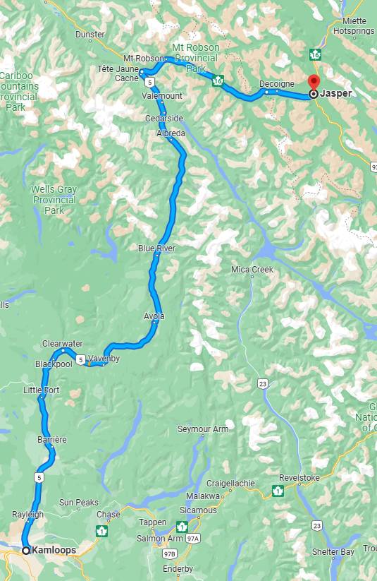
This first part of the three part tour, heads north from Seattle across the Canadian border into British Columbia and then arcs east into Alberta. In total, three riding days and two nights. For those continuing onto the second leg of the tour, day three becomes the first day of that second leg. Otherwise, day three is open to riding out of Jasper in whatever direction one prefers.
Kamloops British Columbia is the first tour destination, a 334 mile 6 hour ride from Seattle. It’s a long day, so best to start early.
Riding in Canada is what this tour is all about and to get there as quickly as possible, follow Interstate 5 north to Bellingham and then head northeast on state routes to the border town of Sumas Washington. These first easy freeway miles are not without pleasant scenes across Skagit Valley farmland, occasional views of the nearby Cascade Mountains and forested hills.
Before crossing the border, take advantage of the gas stations and restaurants in Sumas.
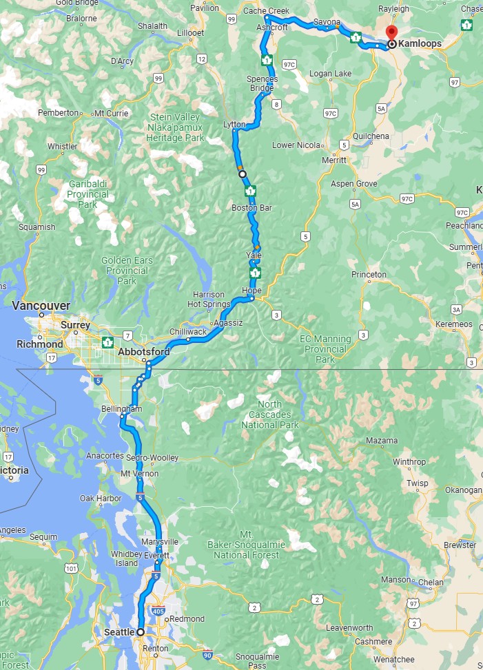
Once across the border, take Trans-Canada Highway 1 to Hope BC. Among the highways that make up the Trans-Canada Highway System, only Highway 1 is referred to simply as the Trans-Canada Highway. Secondary highways are better known by their descriptive names, for example Trans-Canada Highway 16 through Jasper is more often referred to as Yellowhead Highway.
From Hope, the Trans-Canada Highway follows the Fraser River north to Lytton where it then veers east along the Thompson River. At Cache Creek it takes a 90° turn to the east, still closely following the Thompson River, and finally arriving at Kamloops BC.
An enjoyable segment of the riding day begins at Yale BC, a small town 15 miles north of Hope BC. From here the freeway narrows to a two lane rural highway with occasional extra passing lanes. The path runs through the Fraser Canyon closely following the Fraser River contained by thick forests on either side. In seven instances between Yale and Boston Bar, road builders had no choice but to tunnel through canyon walls. Pullouts offer views of the Fraser River and surrounding valley.
A worthwhile stop on the route is at the Hell’s Gate Airtram recreation area. It’s easy to spot a short distance beyond the Hells’ Gate Tunnel. Simon Fraser, the first to explore the region, after seeing the river churn through the narrow passage referred to the gorge as the gates of hell. And the name stuck. Today, visitors are invited to descend 1044 feet into the Hell’s Gate Gorge of the Fraser Canyon, gliding over the surging rapids of the Fraser River. At the base, a tourist village offers snacks and activities, as well as viewing platforms and a bridge over the rapids perfect for picture taking.
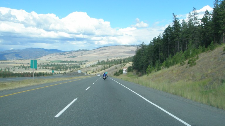
From here the forests begin to thin out as the inland climate becomes more arid. Past Lytton, along the Thompson River, the highway itself seems to hold back the river as it winds through the valley. This section from Lytton to Kamloops is a favorite.
Eventually the river disappears and the road wanders through miles of grass fields and ranch land. The scenery is such that one can be excused for thinking they are in Montana. That is, until they ride up along the shores of Kamloops Lake, a natural lake formed by the confluence of the North Thompson and South Thompson Rivers and surrounded by grassland largely used for grazing cattle.
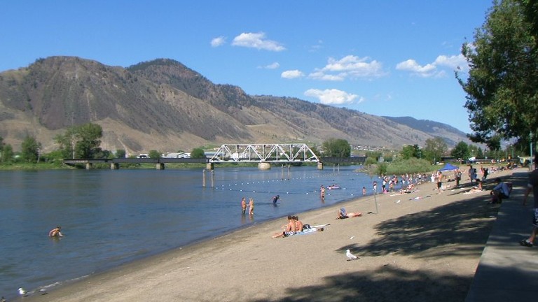
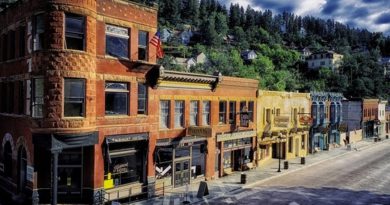
Next stop Kamloops for the evening. Kamloops is surprisingly large town, with a population of nearly 100,000 within the city and nearly 115,000 when including the greater metropolitan area. Like so many inland towns, Kamloops got its start as a railway transportation hub. Today the town is better known for hosting a wide range of amateur sporting events, earning the nickname “Tournament Capital of Canada”.
Riders will find a wide choice of accommodations in Kamloops and plenty of options for food and evening entertainment as well.
On to Jasper – Day 2
Day 1 was all about getting to Kamloops, leaving the urban and near-urban parts of British Columbia behind. Now the ride heads into the Canadian Rockies, climbing from 1200 feet to almost 6000 feet in Jasper Alberta. Get an early start if possible to make the most of the scenic stops along the way.
The first miles out of Kamloops north on BC-5 are a bit uninspiring but necessary. This is the Yellowhead Highway heading north along the North Thompson River. Rolling hills stretch out on both sides of the road and to the horizon. Trees are widely spaced across grassy ranch land. But soon enough, the road narrows to a familiar two lane rural highway and Kamloops drops back in the distance.
This is BC cattle country. Small towns pop-up along the highway offering gas and snacks and not much more. The North Thompson River follows along. At Blackpool BC the elevation has reached 3700 feet, 1600 feet higher than Kamloops but still another 2300 to go before arriving at Jasper.
Near Clearwater BC, the forest returns, surrounding the road with a thick edge of evergreens. Grizzley bears roam the forests of British Columbia. Their populations are among the highest in the southern half of BC in the area north and east of Finn Creek Provincial Park. Keep an eye out for a rare sighting.
BC-5 continues through the Canadian Rockies foothills to Tete Jaune Cache, a small town of 500 named for a blonde-haired native Metis fur trader and trapper whom the French speaking locals called Tete Jaune or Yellowhead. The route to from Hope to Jasper on BC-5 and Trans-Canada Highway 16 is commonly known as the Yellowhead Highway.
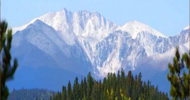
Where BC-5 meets Trans-Canada Highway 16, turn east toward Moose Lake. A few points of interest along the way include Rearguard Falls Provincial Park, a small park overlooking Rearguard Falls where Chinook salmon travel nearly 750 miles to spawn. Next, watch for the Mount Robson Provincial Park. From here one can take in stunning views of Mount Robson, the tallest peak in the Canadian Rockies at 12,972 feet. The visitor center also has informative displays about the area and historical events around Mount Robson.
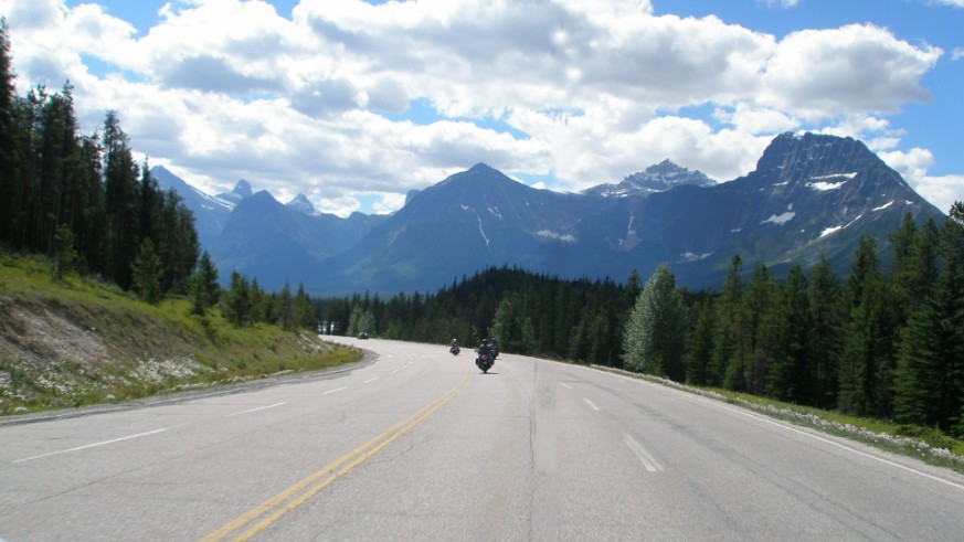
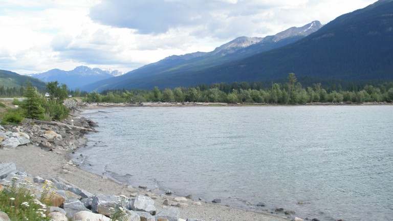
As the ride gets closer to Jasper, past Mount Robson, the vastness of the Canadian Rockies becomes apparent. Snowcapped peaks poke out on the horizon above nearby hills. Suddenly, Moose Lake appears through the trees on an otherwise uneventful and unexpectedly long straight road. The tree covered hills across the lake are mirrored in the turquoise water. This is the only lake formed by the Fraser River. Use the Moose Lake boat launch at the east end for picture taking.
The scenery is both breathtaking and humbling at the same time; and it just gets better riding into Jasper National Park.
The ride crosses out of British Columbia and into Alberta a short distance past Yellowhead Lake at Yellowhead Pass. The historic site overlooks Portal Lake and has several placards describing the history of the region. This is the last stop in British Columbia.
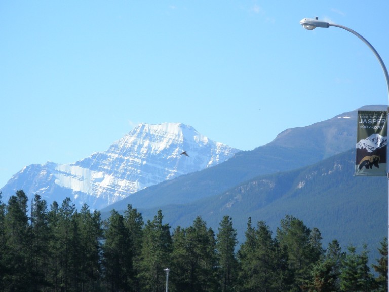
The town of Jasper is only 16 miles farther on the Yellowhead Highway. Technically, riders are entering Jasper National Park at the border with British Columbia and consequently will be expected to purchase a park pass.
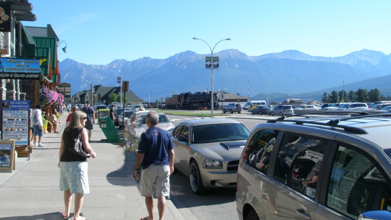
The town of Jasper has 4,590 residents and receives about 2.5 million visitors annually. This town is built for visitors, situated at the center of Jasper National Park. The park visitor center in town can provide maps and information on hiking and other outdoor activities as well as provide park passes.
Outdoor adventure best describes activities in Jasper. Hikes, lakes, and a skytram are all within an easy ride from the center of town.
If time allows only one activity, try the Jasper Skytram on Whistler’s Peak. This aerial tram takes visitors to within 660 feet of the 8,081 foot summit while a guide rides along to call out highlights and explain views of the surrounding area. Once at the summit station, riders can enjoy snacks in the restaurant and take in the sights from a boardwalk. Those who are up for a challenge might want to climb those extra 660 feet for the ultimate view. The relatively short hike (just under a mile each way) is moderately difficult and made more so by the thin air at over 7500 feet.
Should the weather turn cloudy, skip the tram and try a hike instead. There are hiking trails for all levels that begin and end in town. A great way to stretch out after a full day of riding and relax in the alpine air.
Restaurants range from cheap and cheery to elegantly sophisticated. Likewise, hotel accommodations run the gamut, although one won’t find the familiar national chains in Jasper. For a high-end evening cocktail with a lake view, try the Fairmont Jasper Park Lodge. Pub style options with indoor and outdoor seating abound in the heart of the commercial district on either side of Patricia Street.
Tour Part 2 Up Next – Jasper to Waterton via Banff
That wraps up the first part of the Canada Tour. From Jasper, the next segment, covering days 3, 4 and 5, follows the Icefields Parkway to Banff and then on to the Prince of Wales Hotel in Waterton. Get ready to ride through some of the most iconic scenery in Canada. Riding days in part 2 are kept short to allow plenty of time for stops and exploring along the way.
Ride Canada Tour in Three Parts
Did you like this article?
Thank you for your feedback!
Please email the editor with any additional comments.
Your feedback is used only by American Sport Touring. We do not store or sell your information.
Please read our Privacy Policy.
Resources – Ride Canada Tour Part 1
Tour Summary
| Tour Segment | Start At | Ride Miles | Ride Time | End At |
|---|---|---|---|---|
| Day 1 – Into British Columbia | Seattle | 334 | 6hr 7min | Kamloops BC |
| Day 2 – The Canadian Rockies | Kamloops BC | 275 | 4hr 41min | Jasper AB |
| Day 3 – The Icefields Parkway | Jasper AB | 179 | 3hr 30min | Banff AB |
Useful Links
| Resource | Link |
|---|---|
| Motorcyclists Confederation of Canada – Rider information from Canada’s motorcycle association | https://www.motorcycling.ca/ |
| Canada Parks – General information and park pass sales | https://parks.canada.ca/ |
| Jasper National Park Visitor information | https://parks.canada.ca/pn-np/ab/jasper/visit |
| British Columbia road condition and construction updates | https://www.drivebc.ca/ |
| Alberta road condition and construction updates | https://511.alberta.ca/#:Alerts |
| City of Kamloops – Visitor information | https://www.tourismkamloops.com/ |
| City of Jasper – Visitor information | https://www.jasper.travel/visitors-guide/ |