Ride the Olympic Peninsula Loop
The Pacific Northwest, known for green forests and a year-round outdoor lifestyle is also home to the Olympic Peninsula. A rural area covering over 1,442 square miles containing both Olympic National Park and the Olympic National Forest. Landscapes cover the spectrum from stunning coastline to soaring glacial peaks. This off-the-beaten-path part of the country is a must ride for any sport touring rider.
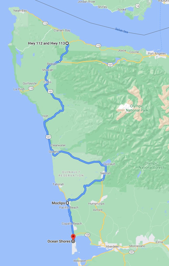
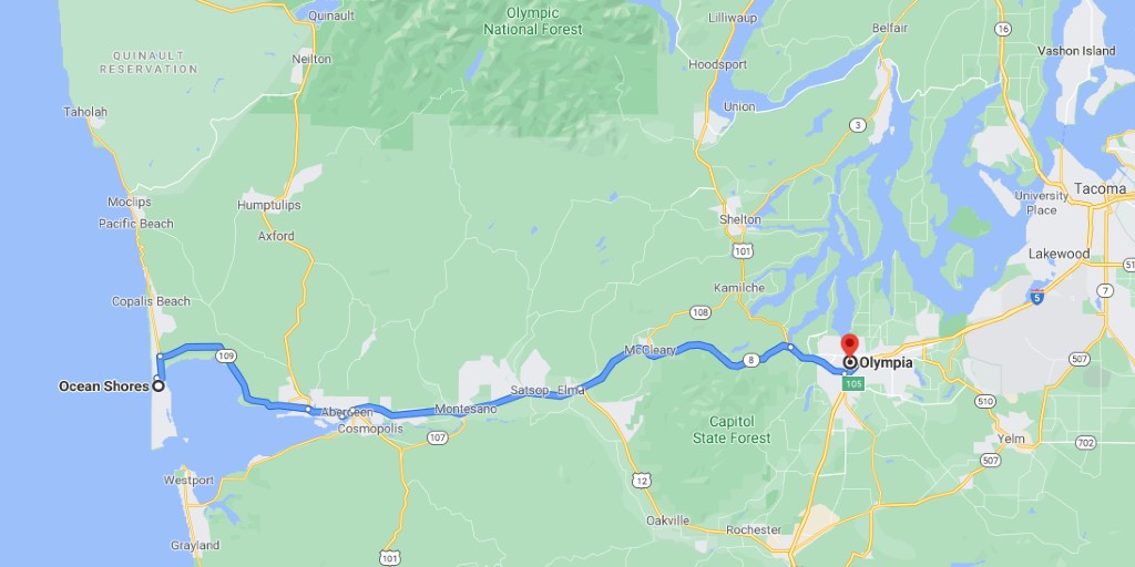
The Olympic Peninsula loop makes for a perfect, albeit long, day ride that can start almost anywhere in the Seattle-Tacoma area. But for some an 8 to 12 hour day ride may feel like too much, in which case consider spending a night at the seaside town of Ocean Shores to stretch the ride an extra day. Either way the great scenery combined with curving rural roads on this ride are sure to impress.
What to Expect
The peninsula loop itself, starting in Olympia Washington, runs 370 miles and should take a little less than 8 hours without stops. Add a recommended side trip to Hurricane Ridge in Olympic National Park and the miles jump to 410 and an almost 10 hour ride. Starting points north or south of Olympia only add to the overall ride time. For example, starting in Tacoma or Seattle would add another 31 or 61 miles respectively, and a lot of lost time spent in unavoidable heavy traffic through dense urban areas.
Chose a starting point that’s right for you and perhaps consider an overnight on the peninsula to break-up the day and allow more time to enjoy the many beaches and parks along the way.
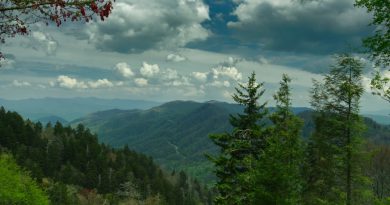
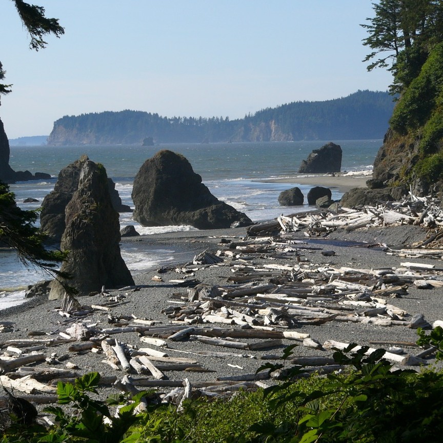
Weather on the Olympic Peninsula varies but is generally moderate with summer temps in the 65 to 70-degree range. Eastern sections benefit from the rain shadow cast by the Olympic Mountains giving towns like Sequim a disproportionate number of sunny days. Areas on the strait, for example Port Angeles or on the Pacific such as Pacific Beach, experience a typical marine climate characterized by cool mornings and mild days. The Olympic National Forest and National Park, in the middle of the peninsula, is part rain forest, part glacial mountain, and the rest old growth forest and lakes. But riding in the national forest and park is not really an option since no roads pass through them. The closest this tour gets is a ride through rain forest valleys near Forks and Quinault.
Check weather and road conditions before heading out. Fuel stops on the peninsula are available and frequent. Port Angeles, the largest town, offers the most gas stations and the best restaurant selection for a lunch stop.
Olympia to Start
For convenience, this tour starts and ends in Olympia Washington, the state capital, and runs counterclockwise; however, feel free to pick a different starting point and to travel in the opposite direction. In the early days Olympia simply provided early settlers with a well located access point to the Puget Sound. Eventually growth in trade combined with statehood made Olympia the seat of Washington government and clinched its place as a major population center. The capital building is majestic, and the surrounding city offers every amenity with the ambiance of a New England town.
Take Highway 101 out of Olympia heading northwest. Interestingly, that’s the only way one can go on Highway 101 at this point since Olympia is the north terminus for this famous coastal road. Bear with it a while as the ride is not particularly scenic for the first 35 miles and the roads offer only occasional modest curves. It gets better.
Eventually the trees clear and Annas Bay pops into view offering a look north on Hood Canal, one of many waterways that make up Puget Sound. The road tip-toes along the edge of the canal for miles passing through one small town after another. Shoreline views combine with ocean smells that change with the tides adding a unique element to the ride.
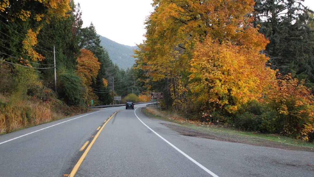
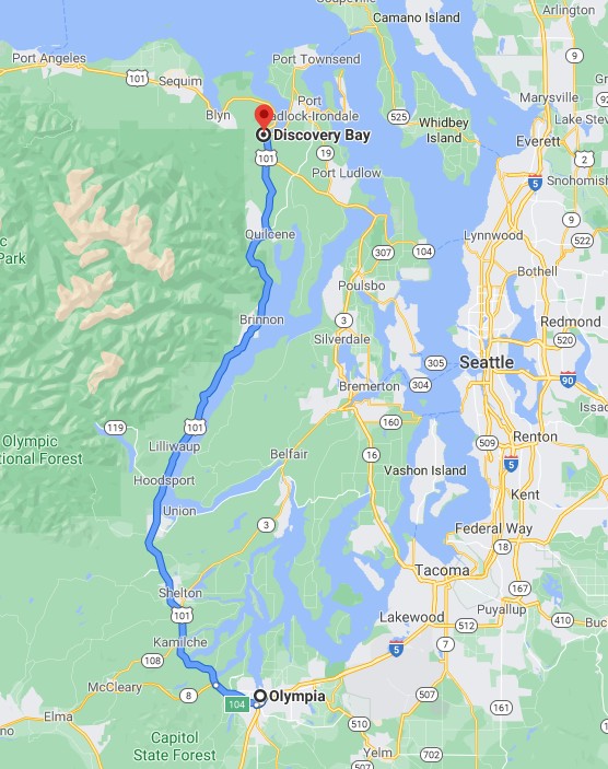
The highway cuts inland a short way past Seal Rock toward Sequim and then Port Angeles as it skirts the edge of the Olympic National Forest. The woods are dense with growth spurred by an abundance of rain and mild temperatures. For those who enjoy riding a well paved forest road this section, along with similar areas on the western side of the peninsula are sure to please. Stay on Highway 101 at Discovery Bay continuing to Sequim.
Once more the highway runs close to Puget Sound although only offering occasional water views; first along Discovery Bay and then to the Strait of Juan de Fuca at Port Angeles.
Port Angeles
Both Sequim and Port Angeles are busy places compared to the serenity of the small towns seen during the previous 100 or so miles. Take East Washington Street off Highway 101 to make a stop in Sequim. Stay on Highway 101 to roll right through the waterfront district of Port Angeles.
Port Angeles is the epicenter of commerce in the north Olympic Peninsula. The town prospers from a diverse economic base including logging, paper and pulp operations, commercial and sports fishing, the oldest Coast Guard station in the country, and ferry service to Victoria the capital of British Columbia. Trivia buffs will be interested to know that Port Angeles is also where John Elway (Denver Broncos QB) was born.
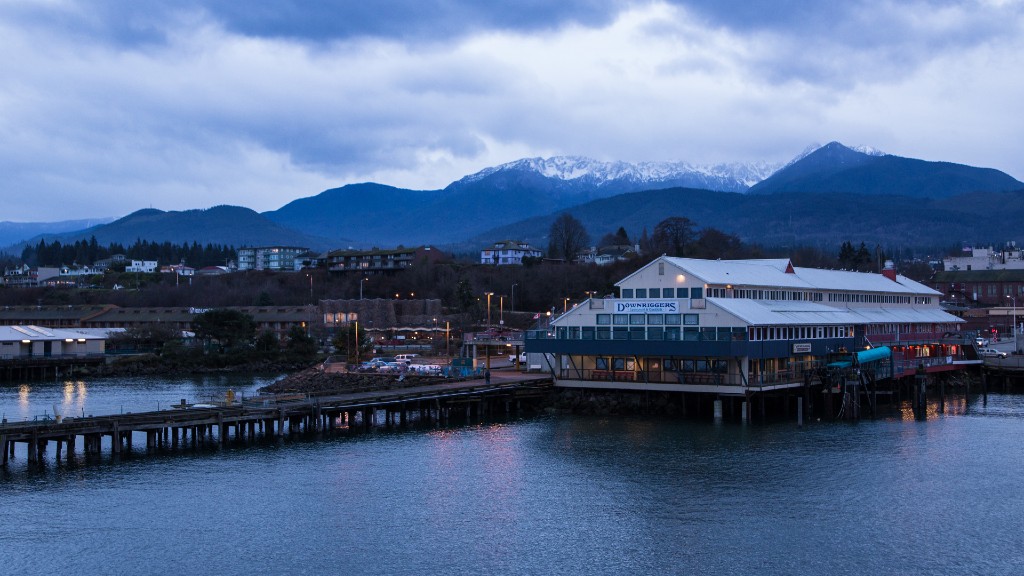
A stop in one of the many local eateries is highly recommended. Check out the Port Angeles events page link in the References & Resources section below.
Hurricane Ridge Road
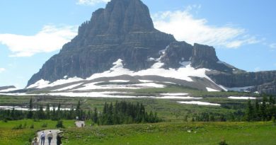
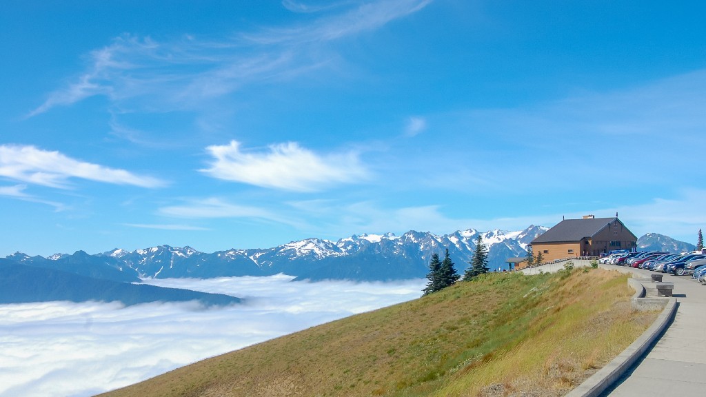
It would be a shame to ride past Port Angeles without making time to also ride the scenic 20 mile Hurricane Ridge Road into Olympic National Park. Start at the Olympic National Park Visitor Center in Port Angeles to pick-up park information and view exhibits explaining the park’s history and many natural features. Then simply follow Hurricane Ridge Road to (you guessed it) Hurricane Ridge.
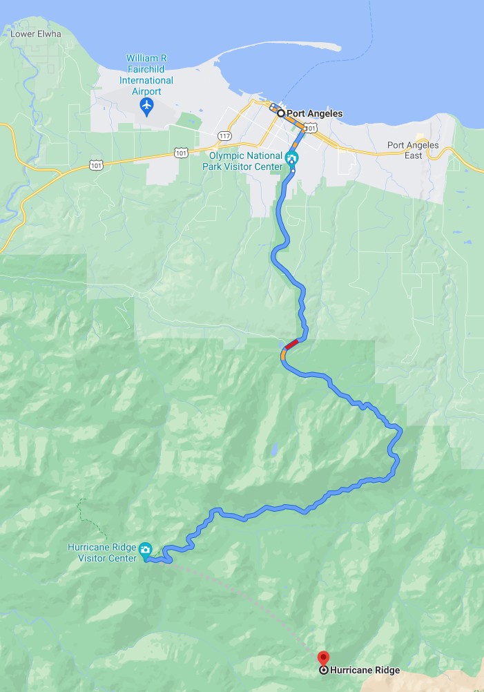
Hurricane Ridge offers viewpoints deep into the National Park from its vantage point at an elevation of 5242 feet. It is the only mountainous point in the park reachable by motor vehicle. In addition to the fantastic views, Hurricane Ridge hosts a visitor center offering guided talks and walks, as well as a snack bar and gift shop.
The only way out is to double back on Hurricane Ridge Road.
The Strait of Juan de Fuca Scenic Byway
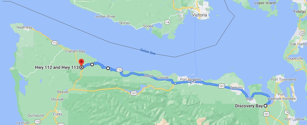
Leave Port Angeles continuing west on Highway 101. About 5 miles out of town turn onto the Strait of Juan de Fuca Scenic Byway (WA-112) toward Neah Bay. Veering a bit farther north adds a few miles to the ride, but the scenery is worth it. The off and on water views fill this part of the ride with sights and scents that are distinct to this northernmost section of the continental United States.
The Strait of Juan de Fuca is both an international border line and a major shipping lane that services the Port of Vancouver Canada and ports in the US including Bellingham, Seattle, and Tacoma. The proximity to Canada is readily apparent from Twin Beach, where the southern tip of Vancouver Island is visible on the other side of the water.
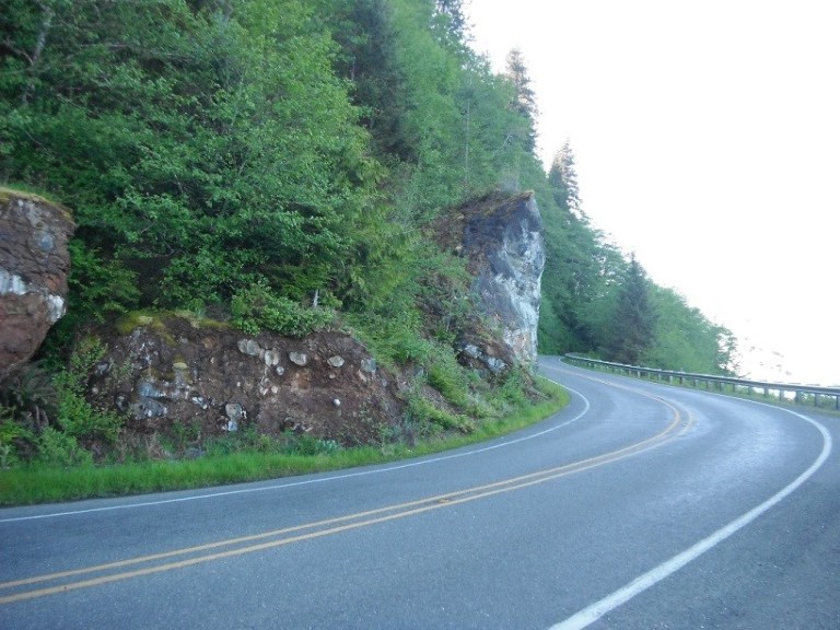
While the roadway starts out looking much like any other Northwest highway, it soon reveals a part of the Pacific Northwest that only the most dedicated touring riders experience. Start with the Elwha River bridge stretching across a wooded canyon where the river far below flows year-round. Not far from there the highway takes a decidedly rural mildly curvy tone as it passes through mile upon mile of ranch land surrounded by forested hillsides.
Eventually as the road approaches the Strait things pick-up. The turns twist more and come closer together. A few sub-20mph hairpin turns season the mix. This section, starting at Shadow and extending all the way to the junction with Highway 101, is by far the most fun part of the highway.
A sign near Twin Beach warns about possible slides and for good reason; the roadway was damaged in December 2020 and remained closed for several months. Check the Washington Department of Transportation site linked in the References & Resources section at the end of this article for current road conditions.
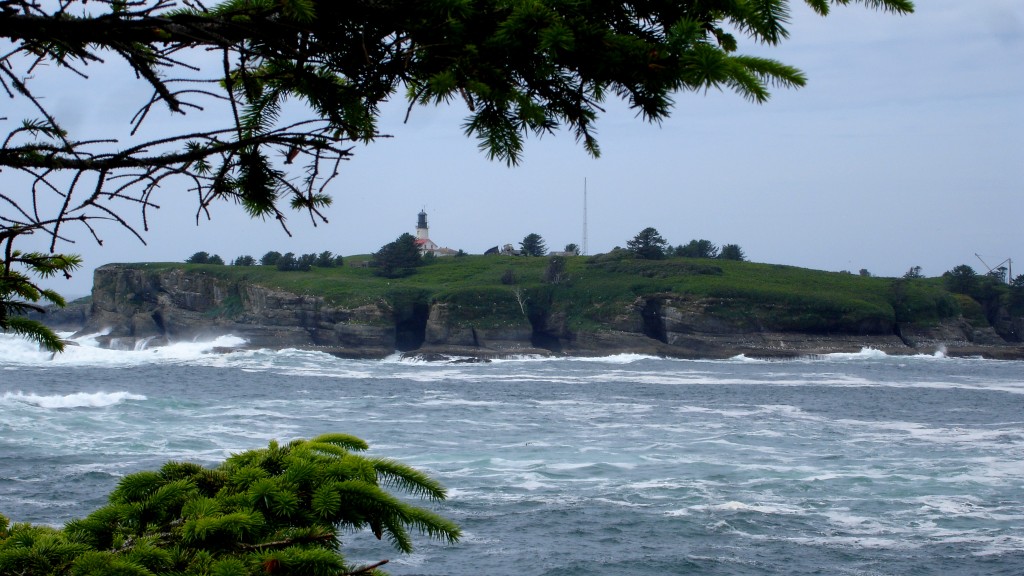
The Strait of Juan de Fuca Scenic Byway continues into the Makah Indian Reservation where it ends at Neah Bay. Neah Bay at the end of the byway, as well as Cape Flattery, which is 8 miles farther on Cape Flattery Road, are worth a visit. The additional 30 miles along the Strait, and the road to Cape Flattery are certainly impressive. Take the ride out and back, or save those notable landmarks for another day and instead keep riding south on WA-112 to the junction with WA-113 and on to Sappho and Forks.
Riding the Peninsula’s West Side
From the northwest corner of the Peninsula, WA-113 winds its way south through lush rural landscapes and a corner of the Olympic National Forest. A good amount of logging is done on the peninsula so don’t be surprised if a hillside is missing a tree or two, or by a heavily loaded logging truck. The northwest is logging country.
The remainder of the route through the Olympic Peninsula follows Highway 101 south. Among the many towns along the way, Forks stands out for being the setting of the show Twilight.
On To Ocean Shores
Keep an eye out for the Moclips Highway on the right where the ride turns west toward to coast. A road sign for the “National Fish Hatchery Visitor Center” marks the turn about 7 miles past Amanda Park on Lake Quinault. The Moclips Highway is a relatively narrow two-lane (paved) road through the Quinault Indian Reservation. The US Fish and Wildlife Service operate a national fish hatchery on the reservation, thus the road sign.
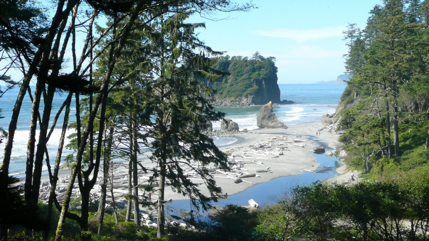
The Pacific Ocean and WA-109 await at the end of the 22 mile Moclips Highway. The small town of Taholah lies 9 miles north of the WA-109 junction. The short ride offers some great views of the Pacific although the road itself is uninspiring. Consider riding this stretch for completeness if time allows.
Heading south on WA-109 from the junction with the Moclips Highway follows the coast through a number of small beach towns and state parks. These towns have distinct but inter-related histories, and all have a rich native American heritage. Moclips was used to film a John Wayne movie in 1974. The US Navy operates a getaway site for military personnel and their families at Pacific Beach. The town of Seabrook was designed with walk-ability in mind and offers a good number of local shops. Copalis features is the only airport in the US that uses a beach for take-offs and landings, tides permitting.
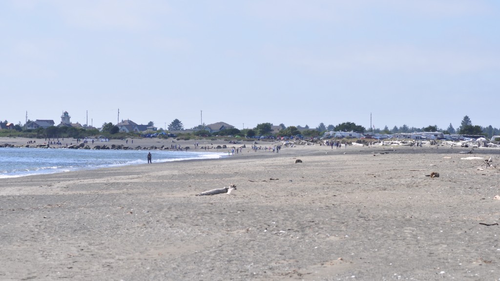
Ocean Shore is well developed. The town offers a good assortment of restaurants scattered around town that cater to a range of tastes and budgets. Hotel choices run the gamut as well. Check the Ocean Shores Guide in the References & Resources section below to find the latest information on amenities.
Aberdeen to Olympia – The last leg
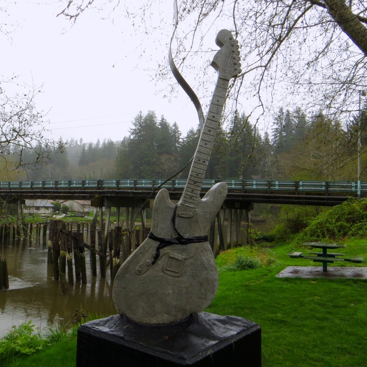
Back on 101, head south to Aberdeen from Ocean Shores. This small seaside town on the bay behind Ocean Shores received a lot of attention with the rise of Nirvana and the whole Seattle grunge music scene.
It turns out Kurt Cobain, who started the band and is often cited as the inventor of Grunge, was born and raised here. Aberdeen is justifiably proud of one of their own. A sign on the edge of town uses the song title “Come As You Are” from Nirvana’s number one selling album Nevermind to welcome visitors. On top of that Cobain Landing on the Wishkah River pays tribute to the artist. The park is worth a brief stop, especially for hard-core grunge fans.
The Olympic Highway, US-12, leads the way from Aberdeen east to Olympia, eventually changing names to WA-8. This section of the state remains rural with a number of small towns offering local crafts and amenities along the way. The road itself, a highway in every sense, is not particularly remarkable. Thankfully it’s a relatively short 60 minute ride to Olympia from Aberdeen.
Not Your Average Peninsula
The Olympic Peninsula is a peninsula in name only. It certainly meets the literal definition having land surrounded by water on three sides. But the sheer mass of land, including a national park and a national forest is beyond what one might imagine. This tour follows Highway 101 from its starting point in Olympia and then circumnavigates the peninsula exploring natural features that characterize Pacific Northwest landscapes. While one day is possible, better to plan a two-day ride allowing more time for exploring beaches and towns along the route.
To read more on motorcycle roads in Washington State, take a look Little Known Washington Motorcycle Roads.
Did you like this article?
Thank you for your feedback!
Please email the editor with any additional comments.
Your feedback is used only by American Sport Touring. We do not store or sell your information.
Please read our Privacy Policy.
References & Resources
Tour Summary
| Segment | Start At | Ride Miles | Ride Time | End At |
|---|---|---|---|---|
| Hood Canal | Olympia WA | 86 | 1h 41m | Discovery Bay |
| Strait of Juan de Fuca | Discovery Bay | 78 | 1h 40m | Junction of WA-112 & WA-113 below Clallam Bay |
| Hurricane Ridge in Olympic National Park | Port Angeles | 20 (40 round trip) | 1h (2h round trip) | Port Angeles |
| The Pacific Coast | Junction of WA-112 & WA-113 | 133 | 2h 43m | Ocean Shores |
| Back to Olympia | Ocean Shores | 73 | 1h 28m | Olympia WA |
Useful Links
| Site | Link |
|---|---|
| Road Conditions | |
| Washington Department of Transportation | https://wsdot.wa.gov/ |
| Peninsula Traffic Alerts | https://www.wsdot.com/traffic/trafficalerts/western.aspx |
| Peninsula Traffic Cameras | https://www.wsdot.com/traffic/cwcam.aspx |
| Strait of Juan de Fuca Scenic Byway road repairs | https://wsdotblog.blogspot.com/2021/02/plans-to-reopen-sr-112-in-clallam.html |
| National Park Information | |
| Olympic National Park | https://www.nps.gov/olym/index.htm |
| Map of Olympic National Park | https://www.nps.gov/olym/planyourvisit/upload/OLYMmap1.pdf |
| City Information | |
| Olympic Peninsula Information | https://olympicpeninsula.org/ |
| Port Angeles Guide | https://www.visitportangeles.com/ |
| Makah Indian Tribe Information | https://makah.com/ |
| Ocean Shores Guide | https://tourismoceanshores.com/ |